Specifications
Display (IFD550/540/545/510)
- 5.7” Diagonal w/Touch Screen
- Full VGA – 640 x 480 pixels
- 65,535 colors
- Ultra bright sunlight readable w/LED Backlighting
Dimensions (IFD550/540/545/510)
- Width: 6.30” (16.0cm)
- Height: 4.60“ (11.7cm)
- Depth: 11.00“(27.5cm) behind panel including connector
Weight (including tray and connectors)
- IFD440 – 6.88 lb (2.34 kg)
- IFD410 – 5.16 lb (3.99 kg)
- IFD550 – 9.19 lb (4.17 kg)
- IFD540 – 8.79 lb (3.99 kg)
- IFD545 – 7.48 lb (3.39 kg)
- IFD510 – 7.13 lb (3.23 kg)
Power Requirements
- 11 – 33VDC
- 4.4A/6.5A Xmit @ 14vdc
- 2.2A/4.0A Xmit @ 28vdc
VHF COM Power Output
- 10 Watts nominal
- Optional 16Watt (for 28vdc installations only)
Environmental
- DO 160E
- To 50,000 Ft
- -20C to +55C Operating
- +70C Short Term
Applicable TSOs
- TSO-C34e – ILS Glide Slope Receiving Equipment Operating within the Radio Frequency Range of 328.6-335.4 Megahertz (MHz)
- TSO-C36e – Airborne ILS Localizer Receiving Equipment Operating within the Radio Frequency Range of 108-112 Megahertz (MHz)
- TSO-C40c – VOR Receiving Equipment Operating within the Radio Frequency Range of 108-117.95 Megahertz (MHz)
- TSO-C44c – Fuel Flowmeters
- TSO-C110a – Airborne Passive Thunderstorm Detection Equipment
- TSO-C112e – Air Traffic Control Radar Beacon System/Mode Select (ATCRBS/Mode S) Airborne Equipment
- TSO-C113a – Airborne Multipurpose Electronic Display
- TSO-C118 – Traffic Alert and Collision Avoidance System (TCAS) Airborne Equipment, TCAS I
- TSO-C128a – Devices that Prevent Blocked Channels Used in Two-Way Radio Communications Due to Unintentional Transmissions
- TSO-C146d – Stand-Alone Airborne Navigation Equipment Using the Global Positioning System (GPS) Augmented by the Wide Area Augmentation System (WAAS).Airborne Supplemental Navigation Equipment Using the Global Positioning System (GPS) – Gamma 3
- TSO-C147 – Traffic Advisory System (TAS) Airborne Equipment – Class A (Display Functions Only)
- TSO-C157a – Aircraft Flight Information Services – Broadcast (FIS-B) Datalink Systems and Equipment
- TSO-C165 – Electronic Map Display Equipment for Graphical Depiction of Aircraft Position
- TSO-C169a – VHF Radio Communications Transceiver Equipment Operating Within The Radio Frequency Range 117.975 To 137.000 Megahertz – Class C, E, 3 and 5
Compatability
Air Data
- B&D 2600 ADC, 2601 ADC, 2800 ADC, 900004-003 ADC
- Bendix King KAD280/480 ADC (KDC 281,481)
- Shadin ADC 2000, ADC 200, ADC 200+, 8800T Alt Computer, 9000T Alt Computer, 9200T Alt Computer, 9628XX-X Fuel/ADC
- Insight TAS 1000 ADC
- Icarus Instrument 3000
- Sandia SAC7-35
- Garmin GDC74A
EFIS
- Avidyne EXP5000
- Bendix King EFS40/50
- Collins Proline 21, EFIS 84 (non-WAAS only)
- Honeywell Primus 1000
- Aspen EFD1000 Pilot PFD
Satellite Datalink Weather Interface
- Avidyne MLB700/WSI AV-300 Broadcast Datalink Receiver
- GDL69/A XM Broadcast Datalink using Baron Wx Services and XM® Satellite Receiver
Electronic Approach Charts & Airport Diagrams
- CMax™ – ™ Electronic Airway Manual Charts (IFD5XX Only)
- European VFR (Bottlang) Charts – optional
Lightning Interface
- Avidyne TWX670 Tactical Lightning Detection
- L3 WX-500 Stormscope® Weather Mapping Sensor
Wx Radar Systems
- Bendix/King RDR2000
Traffic Interface
- Avidyne SkyTrax 600/605/610/615/620/A TAS/AXP322 TIS
- Ryan 9900B/BX TAS
- Honeywell KTA870/KMH880 TAS/IHAS/CAS66A TCAS I
- L3 Skywatch 497 / HP TAS/ 791 TCAS I
- Garmin GTS800/820 TAS/GTS850 TCAS I/ GTX330 TIS
ADS-B Interface
- Avidyne SkyTrax605A/SkyTrax615A/ SkyTrax620A (Traffic)
- Avidyne SkyTrax 100
- Avidyne AXP340, AXP322
- L3-NGT 9000
- FreeFlight RANGR
- Garmin GTX330ES, GTX335, GTX345
Autopilot
- Avidyne DFC90
- Bendix King KFC400, KCP320, KCF325, KFC300, KFC275, KCF225, KCF250, KFC200, KCF150, KAP150, KAP140,KSP100
- Century I, II, III, IV, 21, 31/41, 2000, Triden, AK 1081 GPSS Converter
- Collins APC-65 Series, FGC-65, FYD-65
- STec 20, 30, 40, 50, 55, 55X, 60 PSS, 60-1, 60-2, 65, ST901 GPSS Converter
Audio Panel
- Avidyne AMX240
- Apollo (Garmin) SL10, SL15
- Garmin GMA 340, GMA 347
- PS Engineering 6000, 7000, 8000/8000BT
- Bendix King KMA24, KMA 26, KMA 28, KMA24H
Terrain Awareness
- Color-Contoured Terrain Base Map Built in
- Americas Terrain & US Obstacle Data
- International Terrain Data (optional)
Video Interface
- RS170 (optional)
406 ELT Interface
- Aviation RS-232
- NMEA 0183
Applicable TSOs
- TSO-C34e, TSO-C36e, TSO-C40c, TSO-C44c, TSO-C110a, TSO-C112e, TSO-C113a, TSO-C118, TSO-C128a, TSO-C146d, TSO-C147, TSO-C157a, TSO-C165, TSO-C169a
Documentation
Contact Jeff with Questions or to Schedule your Avionics Consultation
Avidyne IFD 540 GPS Navigator: Advanced Aviation Navigation System for Pilots
$15,949.00
IFD540 FMS/GPS NAVIGATOR
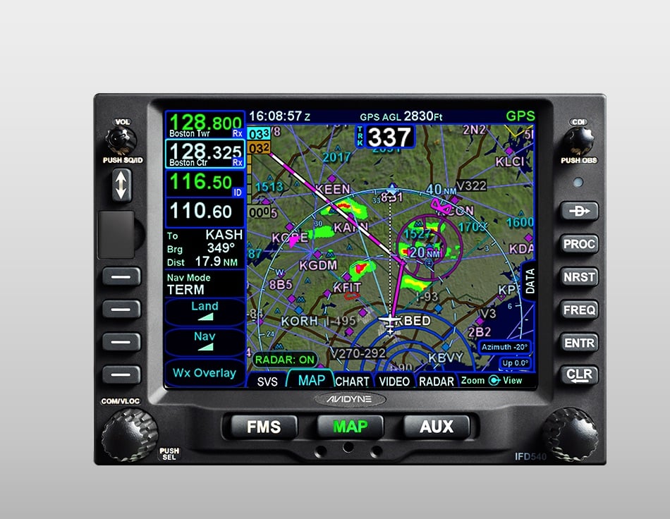
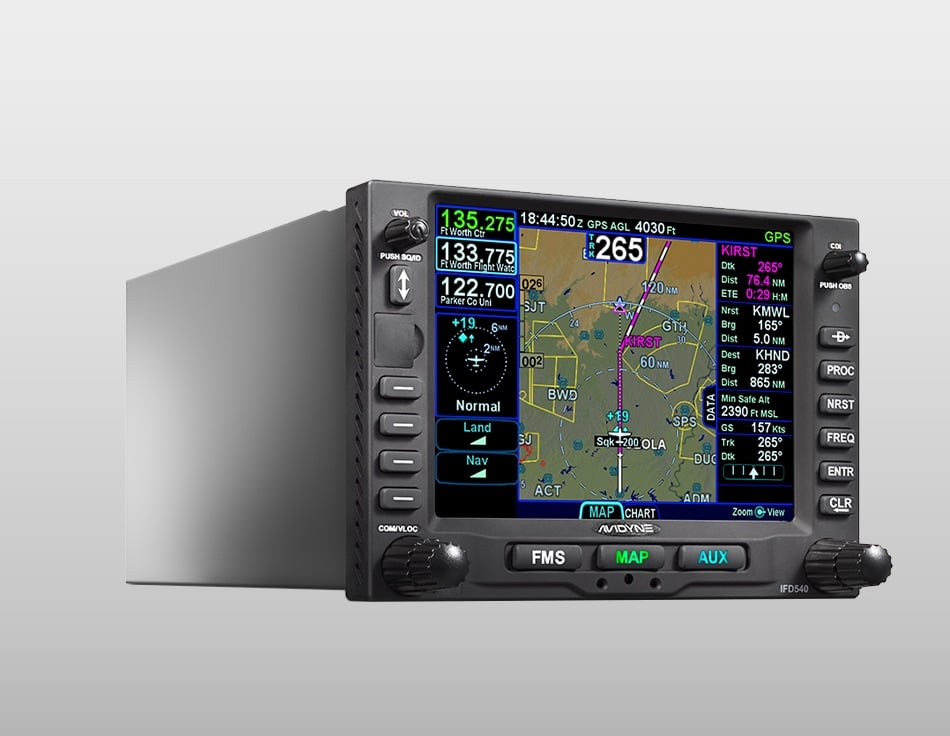
IFD540: The most intuitive FMS/GPS navigator for your Grumman aircraft.
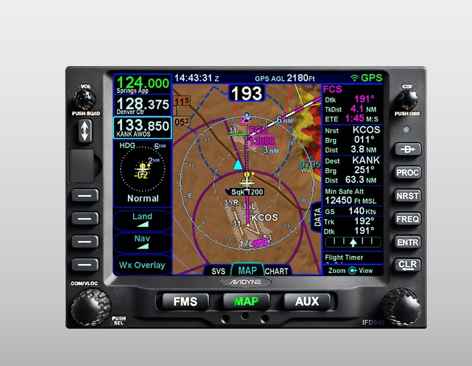
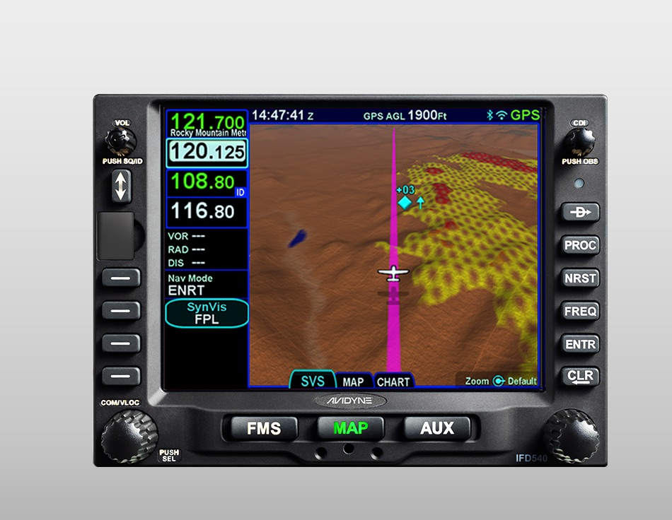
Avidyne’s IFD540 FMS/GPS/NAV/COM is a 5.7” powerful touchscreen navigator with all the benefits and features the IFD Series has to offer. Not only does the IFD540 feature Avidyne’s signature Hybrid Touch, Page & Tab interface with 3D synthetic vision and SBAS/LPV precision but it includes CMax™ Approach Charts and Airport Diagrams.
Out of stock
 Lycoming
O-235, IO-320 Series, LIO-320, AIO-320, AEIO-320, O360, IO360, AIO-360, HIO-360, LIO-360, TIO-360, LHIO-360, AEIO-360, O-540, IO-540, HIO-540, TIO-540, AEIO-540, TIO-541, IO-580, IO-720 Series
Shipping Countries: United States (US), Canada
Ready to ship in 1-3 business days
 Avidyne IFD 540 GPS Navigator: Advanced Aviation Navigation System for Pilots

Reviews
There are no reviews yet